European Renaissance Maps and Pictures | Student Handouts
 
Welcome to Student Handouts--www.studenthandouts.com! 100% free teaching materials for students in kindergarten through high school--lesson plans, worksheets, PowerPoints, outlines, interactive games, puzzles, and so much more!
 
History of the World: Free Worksheets, PowerPoints, Practice Tests, and More, for K-12 World History, European History, and Global Studies
European Renaissance Maps and Pictures
www.studenthandouts.com > World History > Renaissance > Renaissance Maps and Pictures
 
 
  Portion of Old Paris, France, dating to the European Renaissance.  Drawing in style of a map or aerial photograph.   Map of Hapsburg Europe in 1560   A banquet, sixteenth (16th) century.  From a woodcut published in 1549.  The feasters have reached the dessert course consisting of sweetmeats, fruits, and wine.  The furnishings and table service were simple; one used one's fingers or one's own knife instead of a fork.  Bones and scraps were thrown to the floor for the dogs.   Elizabeth I of England (1533-1603)   Renaissance artists of the sixteenth century.  
  Portion of Old Paris - Map   Map of Europe ca. 1560   Renaissance Banquet   England's Elizabeth I   16th-Century Artists  
 
 
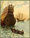
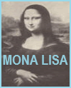
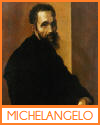
  Renaissance Ships   Conrad Gessner Woodcut with Classical Theme, 1560   Mona Lisa by Leonardo da Vinci.   Leonardo da Vinci (1452-1519)   Michelangelo (1475-1564)  
  Renaissance Ships   Conrad Gessner Woodcut with Classical Theme, 1560   Mona Lisa by Leonardo da Vinci   Leonardo da Vinci (1452-1519)   Michelangelo (1475-1564)  
 
 
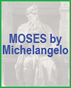
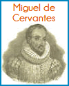
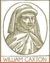
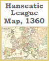
  Moses statue by Michelangelo.   An Elizabethan theater--restoration.  The courtyards of London inns often served as playhouses before regular theaters were built.  These inn yards furnished many suggestions for the early theaters, as the picture shows.  The stage was in one end, and the open space in front served as the pit.  The galleries around the sides afforded additional space for spectators.  The plays were given in the afternoon, as artificial lighting was impossible.  The occupants of the pit had the sky for roof, and had often to seek shelter from storm.  There was almost total lack of scenery.  For example, a painted sign alone indicated Prospero's Island in Shakespeare's Tempest.  The audience welcomed complicated plots and long monologues if these presented ideas of worth.  The theater took the place of lectures, newspapers, and magazines.  The plays of Ben Jonson and William Shakespeare were first given under such conditions.   Miguel de Cervantes (1547-1616)   William Caxton (1412-1491)   Hanseatic League Map, 1360  
  Moses by Michelangelo   Elizabethan Theatre, London, England   Miguel de Cervantes (1547-1616)   William Caxton (1412-1491)   Hanseatic League Map, 1360  
 
 
Renaissance Books and FilmsRenaissance Outlines and PowerPoints
  
Renaissance Maps and PicturesRenaissance Worksheets
  
Renaissance MiscellanyRenaissance Study Games
 
 
www.studenthandouts.com > World History > Renaissance > Renaissance Maps and Pictures