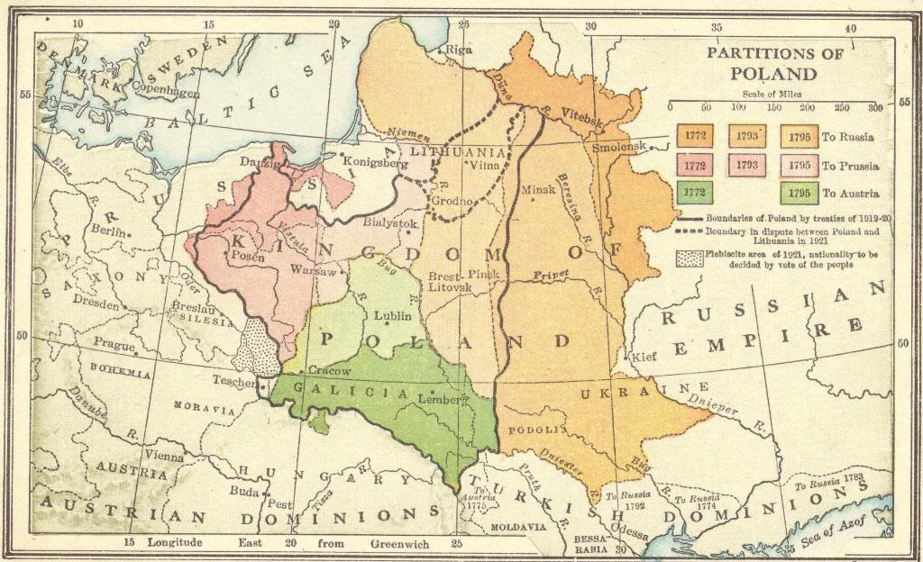
Map of the partitions of Poland to Austria, Prussia, and Russia, in 1772, 1793, and 1795.
Notice how close to the Polish border the city of Kiev (now capital of the Ukraine) was prior to the Russian takeover of the southeastern portion of the Kingdom of Poland that took place in 1793.
The shifting borders of Eastern Europe make it difficult for those studying the history of the region, let alone those studying their genealogical roots in the region. For example, our Shtetl Project has students research the fates of the shtetls, shtots, and dorfs of Eastern Europe. Americans with family roots in shtetls like Brody, Budaniv, and Pliskov in the Ukraine, often describe their European ancestry as Polish. And this makes sense, because these places were technically part of Poland (under Russian control), not officially becoming "Ukrainian" until the Ukrainian National Republic was proclaimed on November 7, 1917. Therefore, anyone emigrating from the western portion of the so-called Ukraine prior to the Russian Revolution of 1917 would more than likely have spoken Polish (as many in the region still do) and would have considered her- or himself to be Polish.
Click here to enlarge this image.
|


