


| Map of the Ancient Near East |
|---|
| www.studenthandouts.com ↣ World History ↣ Ancient Near East ↣ Ancient Near East Images |
 |
|
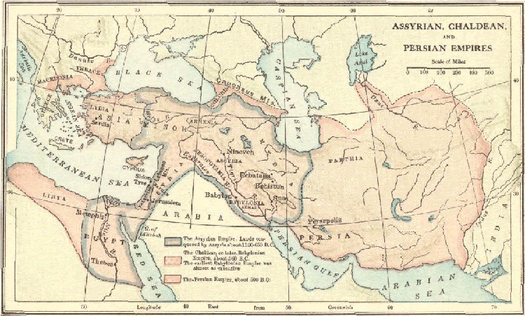
Map of the Assyrian, Babylonian, Chaldean, and Persian empires of Africa, Asia, and Europe, 1100-500 B.C.E. The Assyrian Empire. Lands conquered by Assyria about 1100-650 B.C.E. The Chaldean, or later Babylonian Empire, about 560 B.C.E. The earliest Babylonian Empire was almost as extensive. The Persian Empire, about 500 B.C.E. Click here to enlarge. |
 |  | ") |  |  |  |
| Ancient Near East Books and Films | Ancient Near East Outlines and PowerPoints |
| Ancient Near East Maps and Pictures | Ancient Near East Study Games |
| Ancient Near East Miscellany | Ancient Near East Worksheets |
| www.studenthandouts.com ↣ World History ↣ Ancient Near East ↣ Ancient Near East Images |


