| Color Map of Ancient Egypt |
| www.studenthandouts.com > World History > Ancient Egypt > Ancient Egypt Maps and Pictures |
 |
|---|
|
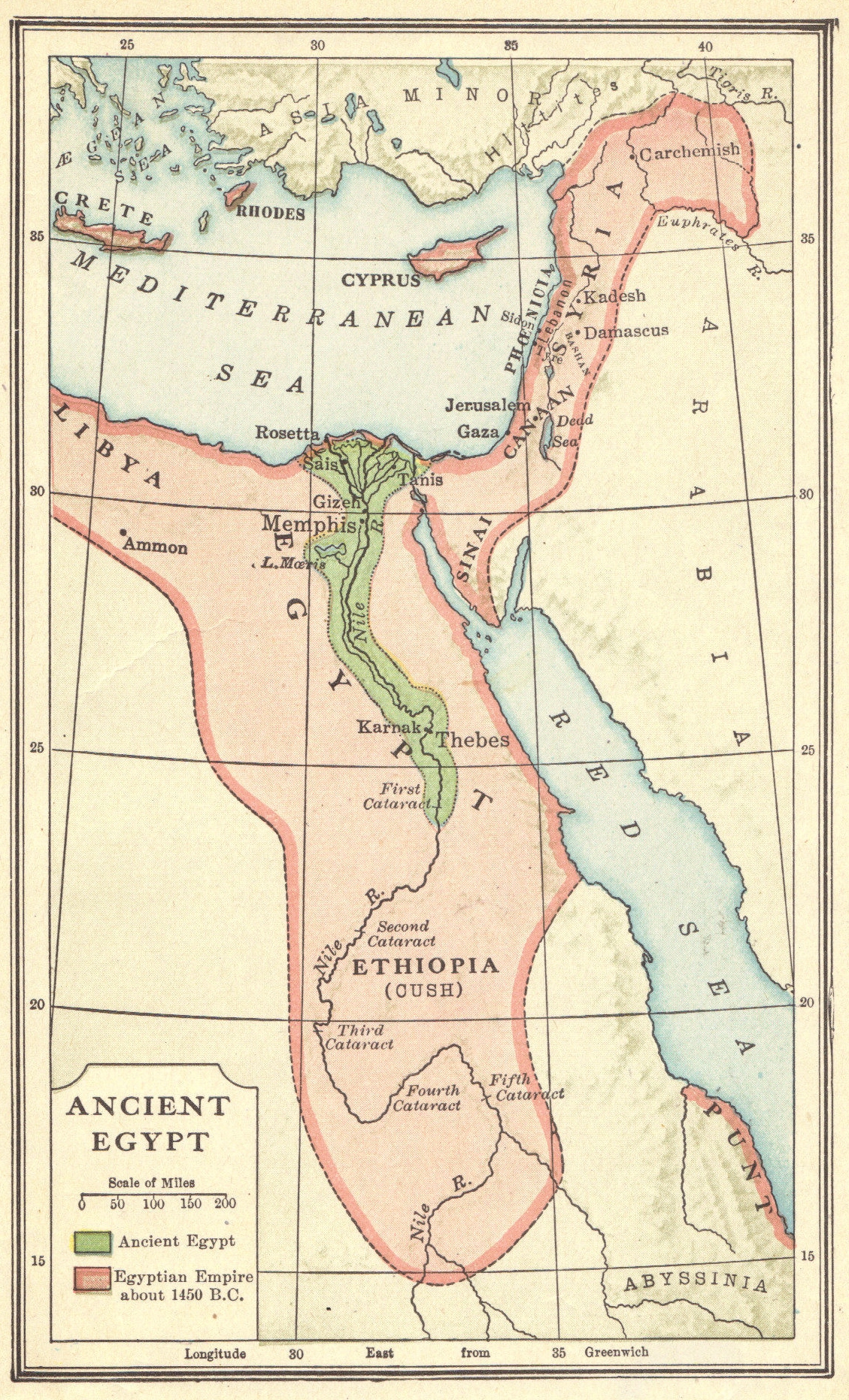
Color map of the territory of ancient Egypt, and of the Egyptian empire about 1450 B.C.E. As can be seen in the map, the empire of ancient Egypt went much further than modern Egypt's boundaries. At its height, ancient Egypt controlled a large portion of the eastern Mediterranean region, including ancient Israel (Palestine), and what would later be the Greek islands of Crete, Rhodes, and Cyprus. Click here to enlarge this image. |
 |
 |
 |
| Ancient Egypt Books and Films | Ancient Egypt Outlines and PowerPoints |
| Ancient Egypt Maps and Pictures | Ancient Egypt Study Games |
| Ancient Egypt Miscellany | Ancient Egypt Worksheets |
| www.studenthandouts.com > World History > Ancient Egypt > Ancient Egypt Maps and Pictures |


