 |
Age of Exploration Maps and Pictures |
|---|
| Student Handouts > World History > Age of Exploration > Age of Exploration Maps & Pictures |
 |
 |
|||||||||
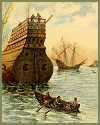
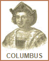
| Christopher Columbus Visiting Ships As a Child | Christopher Columbus (1451-1506) |
|
Maps and pictures are valuable tools for World History students studying the era of European exploration as they provide visual and spatial context for the historical events and geographical discoveries of this period.
Geographical Understanding: Maps provide a clear representation of the world and its regions during the Age of Exploration. They help students understand the locations of continents, countries, oceans, and major geographical features, enabling them to trace the routes of explorers and their discoveries. Route Visualization: Maps illustrate the routes taken by famous explorers like Christopher Columbus, Vasco da Gama, Ferdinand Magellan, and others. Students can follow these routes to understand the extent of the explorations and the challenges explorers faced. Trade Routes: Maps can display major trade routes established during this era, such as the Silk Road or the trans-Atlantic trade routes. These routes facilitated the exchange of goods and cultures, and students can analyze their impact on world history. Cultural Exchange: Pictures and illustrations can depict the encounters between different cultures. For example, they can show how indigenous peoples in the Americas interacted with European explorers, illustrating the exchange of foods, animals, and technologies. Portrayal of Historical Events: Pictures can provide visual representations of significant historical events, such as the arrival of Columbus in the New World, the signing of treaties, or the construction of settlements. This visual context helps students connect with the past. Comparative Studies: Maps and images allow students to compare and contrast the Old World and the New World, enabling them to analyze the impact of exploration on both sides, including the exchange of crops, animals, and diseases. Primary Source Analysis: Students can examine historical maps and illustrations as primary sources. These sources offer insights into the perceptions and knowledge of the time, as well as the biases of mapmakers and artists. Visual Engagement: Visual materials, including maps and pictures, enhance engagement and retention of information. They break up the text-based content and provide a visual narrative of the era. Contextual Understanding: Maps can illustrate the locations of indigenous civilizations, trade centers, and resources, giving students a better understanding of why certain areas were targeted for exploration. Interdisciplinary Learning: Analyzing maps and pictures involves skills such as critical thinking, geography, and visual literacy, providing a well-rounded educational experience. Incorporating maps and images into lessons can help students connect with the historical events and the people involved in the era of European exploration. They make the past come alive and provide a richer understanding of this significant period in world history. |
| Student Handouts > World History > Age of Exploration > Age of Exploration Maps & Pictures |


