| Vanuatu Geography Education |
| www.studenthandouts.com > World Geography > Oceania > Vanuatu |
 |
 |
 |
||||||||
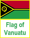
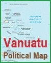
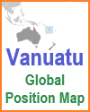
| Flag of Vanuatu | Vanuatu Political Map | Vanuatu Global Position Map |
|
Vanuatu, an archipelago of 83 islands in the South Pacific Ocean, is known for its stunning natural beauty and rich cultural heritage. Located west of Fiji, northeast of New Caledonia, and southeast of the Solomon Islands, Vanuatu covers a land area of approximately 12,200 square kilometers. The capital, Port Vila, is situated on the island of Efate and serves as the political and economic hub of the country.
Vanuatu's population of around 300,000 people is predominantly Melanesian. The country is renowned for its vibrant traditions and customs, with over 100 distinct languages spoken, making it one of the most linguistically diverse places in the world. Traditional practices such as music, dance, and storytelling are integral to Vanuatu's cultural identity, often celebrated in festivals and rituals. Economically, Vanuatu relies on agriculture, tourism, and offshore financial services. Key agricultural products include copra, kava, cocoa, and coffee. Tourism is a growing sector, attracting visitors with the promise of pristine beaches, lush rainforests, and world-class diving sites, including the famous SS President Coolidge wreck. Vanuatu faces challenges such as vulnerability to natural disasters like cyclones, earthquakes, and volcanic eruptions. However, the resilience and strong community bonds of its people contribute to the nation's ability to recover and thrive. Vanuatu continues to preserve its unique cultural heritage while embracing opportunities for sustainable development. |
|---|
 |
| www.studenthandouts.com > World Geography > Oceania > Vanuatu |


