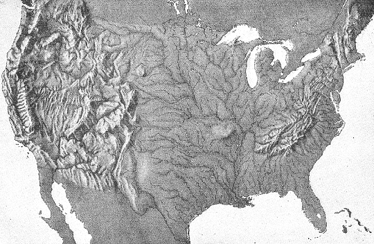
This image is a relief map of the contiguous United States of America (that is, the lower 48 states that are connected and share boundaries).
Possible questions and activities:
1 Where are the U.S.A.'s tallest mountains, in the east or in the west?
2 Identify the Rocky Mountains. Identify the Appalachian Mountains.
3 Where is the flattest land in the country? 4 Can you identify your home state or city without the benefit of political boundaries and place names?
5 Identify the Great Lakes, Pacific Ocean, Atlantic Ocean, and Gulf of Mexico.
Click here to enlarge this image.
|


")
 DBQ Printable")


