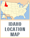
Idaho, located in the Pacific Northwest region of the United States, boasts a diverse and striking geography that contributes to its unique character. The state spans approximately 83,570 square miles, making it the 14th largest in the nation. Its landscape is marked by rugged mountains, vast plains, and deep canyons, reflecting its complex geological history, making the study of Idaho a wonderful opportunity for cross-curricular student learning.
 The Rocky Mountains dominate the eastern and northern parts of Idaho, with the Bitterroot Range and the Sawtooth Range offering some of the most dramatic and picturesque scenery. These areas are known for their alpine forests, crystal-clear lakes, and abundant wildlife, making them popular destinations for outdoor recreation and nature enthusiasts.
In contrast, southern Idaho features the Snake River Plain, a vast arid region characterized by fertile agricultural land and unique geological features such as the Craters of the Moon National Monument. The Snake River itself is a vital waterway that traverses the state, providing essential resources for irrigation and hydroelectric power. It carves through Hells Canyon, the deepest river gorge in North America.
Idaho's diverse geography also includes the high desert regions of the southwest, with expansive sagebrush steppe and dramatic lava flows. The state's varied terrain supports a wide range of ecosystems and climates, from subalpine in the mountains to semi-arid in the plains. This geographic diversity not only shapes Idaho's natural beauty but also its economy, influencing industries such as agriculture, forestry, and tourism.
Teachers may introduce Idaho by asking students what crops grow in the state. Many students will recall that potatoes are grown in Idaho. Teachers can then ask what sort of soil and climate are conducive to potato growth, and build from there.
|


 The Rocky Mountains dominate the eastern and northern parts of Idaho, with the Bitterroot Range and the Sawtooth Range offering some of the most dramatic and picturesque scenery. These areas are known for their alpine forests, crystal-clear lakes, and abundant wildlife, making them popular destinations for outdoor recreation and nature enthusiasts.


