Map of Volcanoes of the Trans-Mexican Volcanic Belt | Student Handouts
 
Welcome to Student Handouts--www.studenthandouts.com! 100% free teaching materials for students in kindergarten through high school--lesson plans, worksheets, PowerPoints, outlines, interactive games, puzzles, and so much more!
 
Map of Volcanoes of the Trans-Mexican Volcanic Belt
Map and Map Worksheet to Print (PDF) Geography > Latin America > Central America > Mexico
 
 
Map of Volcanoes of the Trans-Mexican Volcanic Belt
 
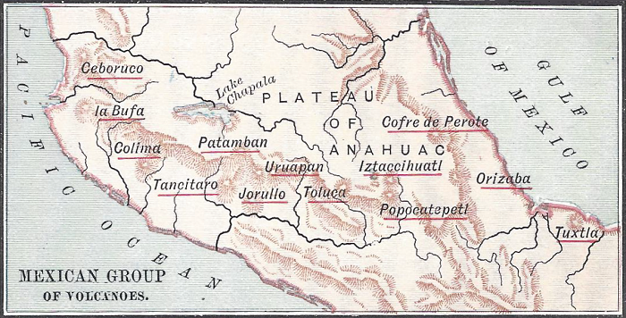
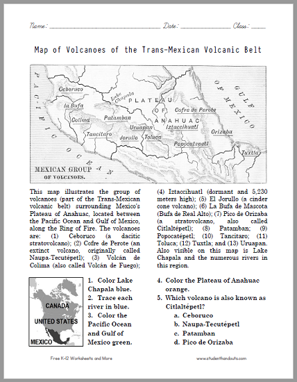
This map (click here to enlarge) illustrates the group of volcanoes (the Trans-Mexican volcanic belt) surrounding Mexico's Plateau of Anahuac, located between the Pacific Ocean and Gulf of Mexico, along the Ring of Fire. The volcanoes are: (1) Ceboruco (a dacitic stratovolcano); (2) Cofre de Perote (an extinct volcano, originally called Naupa-Tecutépetl); (3) Volcán de Colima (also called Volcán de Fuego); (4) Iztaccihuatl (dormant and 5,230 meters high); (5) El Jorullo (a cinder cone volcano); (6) La Bufa de Mascota (Bufa de Real Alto); (7) Pico de Orizaba (a stratovolcano, also called Citlaltépetl); (8) Patamban; (9) Popocatépetl; (10) Tancitaro; (11) Toluca; (12) Tuxtla; and (13) Uruapan. Also visible on this map is Lake Chapala and the numerous rivers in this region.
 
 
Map of Volcanoes of the Trans-Mexican Volcanic Belt Worksheet - Free to print (PDF file).
Free K-12 Education Printables


Click here to print this worksheet. This handy handout is great for students in grades four and up learning about volcanoes. They get to see a map of volcanoes in Mexico along the Pacific Ocean's Ring of Fire, which facilitates their grasp of world geography. The worksheet includes a smaller global position map, indicating where Mexico is located in relation to Canada and the United States. For more of our freebies on Mexico, click here. For our free materials for upper elementary Science, click here.