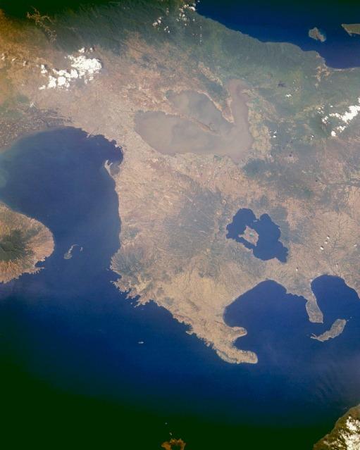
| Trilobed Laguna de Bay, the largest lake in the Philippines, is visible near the upper center of this east-looking photograph of central Luzon, Philippines. The lake is more than 51 kilometers (32 miles) long and covers 891 square kilometers (344 square miles). Its outlet, the Pasig River, exits at the northwest corner of the lake, flows westward through Manila, and empties into Manila Bay. South of Laguna de Bay are the dark blue waters of Taal Lake, a filled caldera that surrounds Volcano Island. The island is home to Taal Volcano (300 meters; 948 feet high) with a crater more than 2 kilometers (1 mile) wide. The island of Corregidor, which served as the focal point in the defense of the city of Manila during World War II, is the tiny tadpole-shaped island at the entrance to Manila Bay in the center left. Photo courtesy of NASA (National Aeronautics and Space Administration of the United States). |