
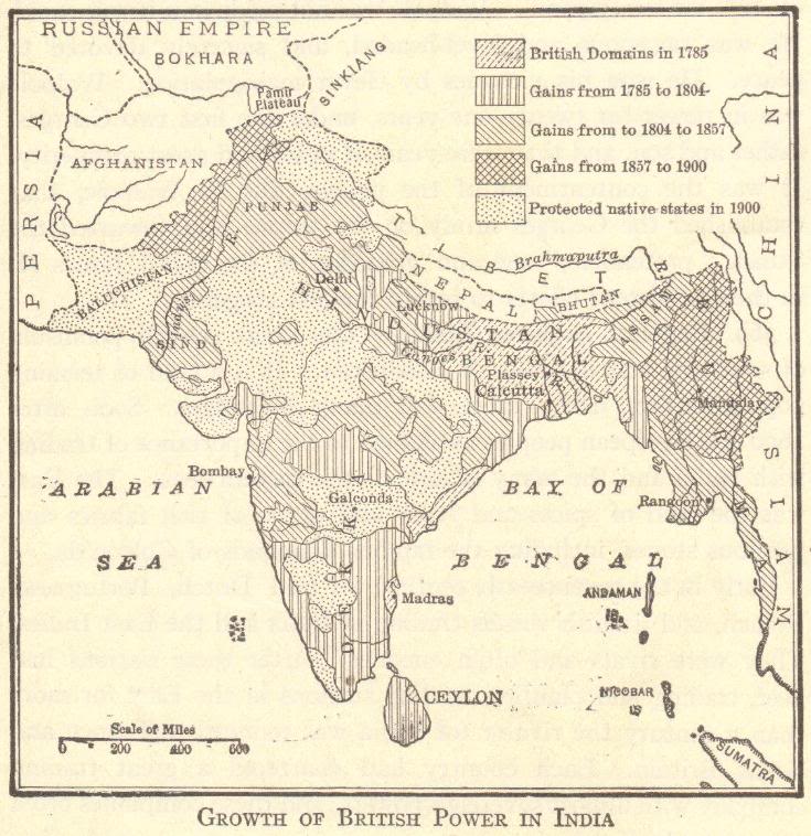
| Map of the British Empire in India |
|---|
| www.studenthandouts.com ↣ Geography ↣ Asia ↣ South-central Asia ↣ India ↣ India Images |
 |
|
Great Britain's Indian empire: Map of the growth of British imperial power in India, 1785-1900.
British domains in 1785; Gains from 1785 to 1804; Gains from 1804 to 1857; gains from 1857 to 1900; Protected native states in 1900; Baluchistan; Punjab; Sind; Hindustan; Bengal; Assam; Burma; Nepal; Bhutan; Dekkan; Ceylon; Andaman; Nicobar; etc. |
 |  |  |  |  |  |
| Imperialism Books and Films | Imperialism Outlines and PowerPoints |
| Imperialism Maps and Pictures | Imperialism Educational Games |
| Imperialism Miscellany | Imperialism Worksheets |
| www.studenthandouts.com ↣ Geography ↣ Asia ↣ South-central Asia ↣ India ↣ India Images |