


| Afghanistan Map Worksheet |
|---|
| www.studenthandouts.com ↣ World Geography ↣ Asia ↣ South-central Asia ↣ Afghanistan |
 |
    |
|
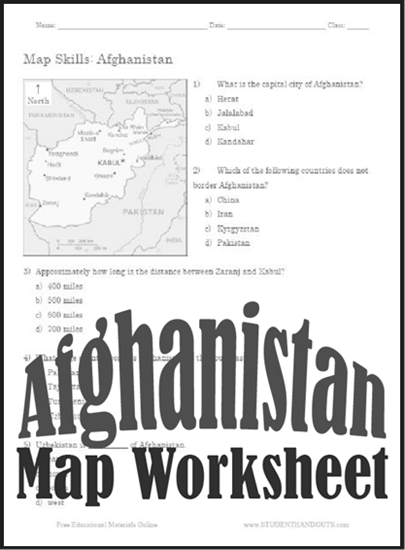
1) What is the capital city of Afghanistan? a) Herat b) Jalalabad c) Kabul d) Kandahar.
2) Which of the following countries does not border Afghanistan? a) China b) Iran c) Kyrgyzstan d) Pakistan. 3) Approximately how long is the distance between Zaranj and Kabul? a) 400 miles b) 500 miles c) 600 miles d) 700 miles. 4) What large country borders Afghanistan to the southeast? a) Pakistan b) Tajikistan c) Turkmenistan d) Uzbekistan. 5) Uzbekistan is __________ of Afghanistan. a) east b) north c) south d) west. Click here to print. Answer Key: (1) C - Kabul; (2) C - Kyrgyzstan; (3) B - 500 miles; (4) A - Pakistan; (5) B - north |
 |
| www.studenthandouts.com ↣ World Geography ↣ Asia ↣ South-central Asia ↣ Afghanistan |


