Our free maps and pictures can be powerful tools for American History students to better understand the events of the turn of the nineteenth century (late 18th to early 19th century) by providing visual context, clarifying geographic locations, and offering insights into the period's culture and society.
Geographic Understanding:
- Territorial Changes: Maps can illustrate the territorial boundaries of the United States during this period, including the original thirteen colonies, western expansion, and the Louisiana Purchase.
- Key Locations: Maps help students locate and visualize the settings of major events, battles, and conflicts, such as the War of 1812, Lewis and Clark's expedition, and the Missouri Compromise.
Battles and Military Campaigns: Detailed battle maps can show the terrain, troop movements, and strategies employed in significant conflicts, aiding students in understanding the tactics and outcomes of battles like the Battle of New Orleans or the Battle of Lake Erie.
Political Changes and Diplomacy:
- Territorial Agreements: Maps can display the results of diplomatic negotiations, like the Treaty of Ghent, which ended the War of 1812, and the boundaries established by the Louisiana Purchase.
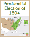
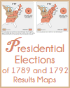
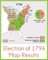
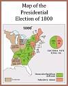
- Election Maps: Visual representations of presidential elections, such as the election of 1800, can help students see how the political landscape evolved.
Migration and Westward Expansion:
- Migration Routes: Maps can highlight the westward migration of settlers, pioneers, and explorers, including the paths taken by Lewis and Clark on their expedition.
- Land Policies: Visuals can illustrate land acquisition methods, like the Northwest Ordinance and the distribution of public lands, that encouraged westward movement.
Native American Displacement: Maps can show the locations of Native American tribes and how their territories were affected by westward expansion and conflicts.
Cultural and Social Context:
- Portraits and Artwork: Pictures, paintings, and portraits of notable figures, such as Thomas Jefferson or Andrew Jackson, provide visual insight into the appearance and dress of people from that era.
- Artistic Representations: Artwork and illustrations can depict scenes from daily life, battles, or significant events, offering glimpses into the period's culture and society.
Infrastructure and Transportation: Maps can depict early transportation routes, like roads, canals, and the Erie Canal, showcasing the development of infrastructure during this period.
Growth of Urban Centers: Maps of cities like Washington, D.C., or Baltimore, can illustrate their layouts and urban development during the early 19th century.
Symbolism and National Identity: Visuals can include national symbols like the American flag and the national anthem, helping students understand their significance in shaping American identity.
Interdisciplinary Insights: Images of buildings and architectural plans can provide insights into the period's architectural styles and city planning. |
