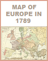
These maps provide a geographical context, helping your students understand the locations of key events and places associated with the French Revolution, such as the Bastille. This is particularly important when studying the spread of revolutionary ideas, military campaigns, and the regions affected by the revolution.
 Maps illustrate the spatial relationships between different regions, cities, and countries involved in the French Revolution, such as Paris. Your students can grasp the distances between Paris, major cities, and neighboring countries, which influenced the course of the revolution. Our maps can show how the territorial boundaries of France evolved during the revolutionary period, including the expansion and contraction of the French Republic and its influence on neighboring states. France was regaining territory, like Franche-Comté, a fact that did not please its neighbors.
Our visual representations of battles and military campaigns, with arrows, symbols, and labels, can help your students understand the strategic and tactical aspects of the conflict. Maps make it easier to comprehend the movements of armies and the outcomes of battles. Maps can highlight regional differences within France and the varying degrees of revolutionary fervor in different areas. This is essential for understanding the diversity of experiences during the revolution.
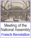
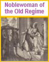
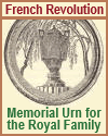
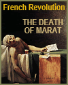
Historical illustrations, paintings, and drawings from the era can immerse your students in the visual context of the French Revolution. They can see the clothing, architecture, and everyday life of the time. Primary visual sources, such as political cartoons, posters, and pamphlets, provide insights into the political and social issues of the era. Students can analyze these sources to understand the perspectives of different groups. Portraits and depictions of key figures in the French Revolution, such as Robespierre, Marat, and Louis XVI, help students connect faces to names and understand the role of individuals in the revolution.
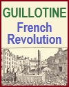
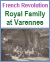
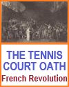
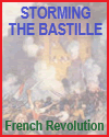
Visual materials can reveal the use of symbols and iconography during the revolution, including the tricolor flag, the liberty cap, and guillotines. Analyzing these symbols deepens students' understanding of revolutionary propaganda and its impact. Paintings and drawings of major events, like the storming of the Bastille or the execution of Louis XVI, allow your students to visualize these critical moments and their significance. Depictions of everyday life during the revolution, such as market scenes, revolutionary festivals, and urban environments, provide insight into the social and cultural aspects of the period.
To maximize the effectiveness of our free maps and pictures, teachers can incorporate them into lessons, presentations, and assignments. Encourage your students to analyze and interpret these visual sources, helping them develop critical thinking skills and a deeper understanding of the French Revolution's multifaceted history. Additionally, these maps and pictures can be used to spark discussions, promote inquiry-based learning, and make the study of history more engaging and memorable.
|